personal info

engineer abdur rehman

Monday, 7 January 2019

Components of hydrological cycle


Components of hydrologic cycle


World Water Budget


Total quantity of water in the world is estimated as 1386 M km3
         1337.5 M km3 of water is contained in oceans as saline water
        The rest 48.5 M km3 is land water
13.8 M km3 is again saline
34.7 M km3 is fresh water
        10.6 M km3 is both liquid and fresh
        24.1 M km3 is a frozen ice and glaciers in the polar regions and mountain tops


Estimated World Water Quantities


Global annual water balance


Water Balance of Continents


Water Balance of Oceans


Application in Engineering
Hydrology finds its greatest application in the design and operation of water resources engineering projects
        The capacity of storage structures such as reservoir
        The magnitude of flood flows to enable safe disposal of the excess flow
        The minimum flow and quantity of flow available at various seasons
        The interaction of the flood wave and hydraulic structures, such as levees, reservoirs, barrages and bridges

Basic Hydrology Concept


Basic Hydrology Concept

Introduction

Water is vital for all living organisms on Earth.
For centuries, people have been investigating where water comes from and where it goes, why some of it is salty and some is fresh, why sometimes there is not enough and sometimes too much. All questions and answers related to water have been grouped together into a discipline.
The name of the discipline is hydrology and is formed by two Greek words: "hydro" and "logos" meaning "water" and "science".

What is Hydrology?

  • It is a science of water.
  • It is the science that deals with the occurrence, circulation and distribution of water of the earth     and earth’s atmosphere.
  •  A good understanding of the hydrologic processes is important for the assessment of the water resources, their management and conservation on global and regional scales.
  • In general sense engineering hydrology deals with
  • Estimation of water resources
  • The study of processes such as precipitation, evapotranspiration, runoff and their interaction
  • The study of problems such as floods and droughts and strategies to combat them


Hydrologic Cycle

Water exists on the earth in all its three states, viz. liquid, solid, gaseous and in various degrees of motion.


Water, irrespective of different states, involves dynamic aspect in nature.
The dynamic nature of water, the existence of water in various state with different hydrological process result in a very important natural phenomenon called Hydrologic cycle.
Evaporation of water from water bodies, such as oceans and lakes, formation and movement of clouds, rain and snowfall, stream flow and ground water movement are some examples of the dynamic aspects of water. 


  • Evaporation from water bodies
  • Water vapour moves upwards
  • Cloud formation
  • Condensation
  • Precipitate
  • Interception
  • Transpiration
  • Infiltration
  • Runoff–streamflow
  • Deep percolation
  • Ground water flow


The hydrologic cycle has importance influence in a variety of fields agriculture, forestry, geography, economics, sociology, and political scene.
Engineering application of the knowledge are found in the design and operation of the projects dealing with water supply, hydropower, irrigation & drainage, flood control, navigation, coastal work, various hydraulic structure works, salinity control and recreational use of water.  

Water Budget Equation

Catchment area

  • The area of land draining in to a stream or a water course at a given location is called catchment area / drainage area / drainage basin / watershed.
  • A catchment area is separated from its neighbouring areas by a ridge called divide / watershed.  
  • A watershed is a geographical unit in which the hydrological cycle and its components can be analysed. The equation is applied in the form of water-balance equation to a geographical region, in order to establish the basic hydrologic characteristics of the region. Usually a watershed is defined as the area that appears, on the basis of topography, to contribute all the water that passes through a given cross section of a stream.


If a permeable soil covers an impermeable substrate, the topographical division of watershed will not always correspond to the line that is effectively delimiting the groundwater.


Watershed characteristics


For a given catchment, in an interval of time ∆t, the continuity equation for water in its various phases can be given as:
                Mass inflow – Mass outflow = change in mass storage
If the density of the inflow, outflow and storage volumes are the same:
Vi - Inflow volume in to the catchment, Vo - Outflow volume from the catchment and ∆S - change in the water volume
Therefore, the water budget of a catchment for a time interval ∆t is written as:
                P – R – G – E – T = ∆S
P = Precipitation, R = Surface runoff, G = net ground water flow out of the catchment, E = Evaporation, T = Transpiration, and ∆S = change in storage 
The above equation is called the water budget equation for a catchment
               

NOTE: All the terms in the equation have the dimension of   volume and these terms can be expressed as depth   over the catchment area.


give feed back in coment box about this post 


Saturday, 5 January 2019

ENGINEERING GEOLOGY IN DAM CONSTRUCTION


ENGINEERING GEOLOGY IN DAM CONSTRUCTION

Introduction:
  • Geological considerations play a vital role in location of Dams & Reservoir.
  • Type of dam is based on valley characteristics & Geology.
  • Foundation requirements also depend on the type of the dam.
  • Dams intended for more than one purpose are called “Multi-purpose dams”


Dams are constructed for:

  1. Generation of hydroelectricity,
  2. Irrigation,
  3. Flood control,
  4. water storage or supply and
  5. Regulating & control of stream load.


 Most of the dams in India (90%) are operating for irrigation only.

TYPES OF DAMS

GRAVITY DAM:

  • These are heavy concrete dams.
  •  Stability is secured by making it of such a size and shape that it will resist overturning, sliding and crushing at the toe.


ARCH DAM:

  • In Arch dam, stability is obtained by a combination of arch and gravity action.
  • Firm reliable supports at the abutments (either buttress or canyon side wall) are more important.
  • The most desirable place for an arch dam is a narrow canyon with steep side walls composed of sound rock.


Buttress dam:

  • Buttress dam is a water-tight dam supported at intervals on the downstream side by a series of buttresses or supports.
  • The dam wall may be flat or curved.
  • A buttress dam is a good choice in wide valleys where solid rock is rare.


EARTH DAM:

  • Constructed with earth materials.
  • This is large in size and Trapezoidal in shape.
  • Earth materials used in construction are gravel, sand, silt and clay.
  • Filters are provided to facilitate drainage and also to release pore-pressure.


Location of a dam: (Ideal site)

  1. Narrow valley with steeper side slopes.
  2. Stable slopes .
  3. Absence of weathered formations, clay and fractured material .
  4. Absence of weak zones .
  5. Reservoir should be water tight .
  6. Easy access and supply of materials for construction site .


Friday, 4 January 2019

DAMS CONSTRUCTION AND SIDE SELECTION


DAMS

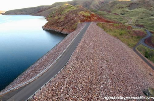
. A dam may be defined as a solid barrier constructed at suitable location Across river valley with a view of impounding water flowing through That River.
                                                     OR
. Dams  are hydraulic structure built across rivers and stream to confine water
On upstream side and utilize this flow of water for multipurpose.


Dams are created for the following  objectives  Or  Purpose

  • Generation of hydropower energy.
  • Providing water for irrigation facilities.
  • Fish farming.
  • Fighting droughts.
  • Controlling of floods.
  • Water supply for domestic consumption.
  • Providing navigational facilities.


DIFFRENT PARTS AND TERMINOLOGIES OF DAMS

Crest:

The top of the dam. These may be in some cases be used for providing a roadway or walkway over the dam.

Parapet walls:

low protective walls on either side of the roadway or walkway on the crest.

Spillway:

A spillway is a section of a dam designed to pass water form the upstream side of a  dam      to the downstream side.
Many spillways have floodgates designed to control the flow through the spillway

Free Board:

This is the free board can be defined as the distance   between the mix water level normal water level of the dam this distance between the maximum and normal water level it is called free board.

Gallery:

A gallery is the small tunnel like way for the different purposes it may be provided and the longitudinal        direction are in the transverse direction provided for storage of the equipment used to determine the performance of the building or the small spaces room provided for the people to live . The dam specification inside this room . A passage tunnel provided inside the dam .

Sluice way:

A provided to clear the silt accumulation in the reservoir .

Heel:

Portion   of the dam in contact with ground or river- bed at upstream side.

Toe:

portion of the dam in contact with ground or river-bed downstream side.


Types of Dams

Classification of dams can be two types.

  • Based on function .
  • Based on structure and design .


BASED ON FUNCTION:

.Storage dam. 
                     It is a structure
 The major purpose of this structure is to store water.

.Diversion dam.

The major purpose f a diversion is to divert the water form its natural
 course.

Detention dam.

In detention dam this also serves the purpose of a storage dam but this detention dam prevents the floods at a entering into downstream area this detention dam retains water in releases it gradually to the downstream down this prevents a floods to flood prone areas.

Debris dam.

This dam prevents all the debris like silt and sand , locks of wood leaves entering into the downstream side.

Coffer dam.

 Coffer dam is temporary structure which major purpose it restricts the water entering into the construction site well construction process is going so this is temporary structure.

BASED ON STRUCTYE AND DESIGN:

Gravity dam.

The gravity dam is the massive concrete or Rockville structure with the weight of the dam itself restricts the horizontal thrust of the water. The gravity dam have strong foundation


Arch dam.

In this arch dam we have it is curved in plan.it has a convexity on the upstream side This diverts the horizontal thrust to the strong abutments.

Buttress dam.

This dam has a long concrete reinforced concrete slab which is supported by these buttresses this structure totally restricts the horizontal thrust of the water.

Embankment dam.

The section of this dam looks like an embankment it looks like an hill where you have an impervious core. Coming to its strength this don`t have concrete and asphalt as its major ingredients.

SELECTION OF DAM SITE.

  • Suitable foundation must be available.
  • For economy, the length of the dam should be as small as possible, and for a given height, it should store the maximum volume of water.
  • The general bed level at dam site should preferably be higher than that of the river basin. This will reduce the height of the dam.
  • A suitable site for spillway should be available in the near vicinity.
  • Materials required for the construction of dam should be easily available, either locally or in the near vicinity.
  • The value of land and property submerged by the proposed dam should be as low as possible.
  • The dam site should be easily accessible, so that it can be economically connected to important towns and cities.
  • Site for establishing labor colonies and a healthy environment should be available near the site. 


Wednesday, 2 January 2019

INTERNAL STRUCTURE OF EARTH


INTERNAL STRUCTURE OF EARTH

The Earth is composed of four different layers. The crust is the layer that you live on, and it is the most widely studied and understood. The mantle is much hotter and has the ability to flow. The outer core and inner core are even hotter with pressures so great you would be squeezed into a ball smaller than a marble if you were able to go to the center of the Earth!


The Crust

The Earth's Crust is like the skin of an apple. It is very thin in comparison to the other three layers. The crust is only about 3-5 miles (8 kilometers) thick under the oceans (oceanic crust) and about 25 miles (32 kilometers) thick under the continents (continental crust).


    The crust is composed of two rocks. The continental crust is mostly granite. The oceanic crust is basalt. Basalt is much denser than the granite. Because of this   the less dense continents ride on the   denser oceanic plates.


The Mantle

The Mantle is the largest layer of the Earth. The middle mantle is composed of very hot dense rock that flows like asphalt under a heavy weight. The movement of the middle mantle (asthenosphere) is the reason that the crustal plates of the Earth move.


The Outer Core

The core of the Earth is like a ball of very hot metals. The outer core  is so hot that the metals in it are all in the liquid state. The outer core is composed of the melted metals of nickel and iron.


The Inner Core

The inner core of the Earth has temperatures and pressures so great that the metals are squeezed together and are not able to move about like a liquid, but are forced to vibrate in place like a solid.


The Layers of the Earth


HYDROLOGICAL MEASUREMENTS


HYDROLOGICAL MEASURMENTS

Wind speed

                         Wind speed, or wind flow velocity, is a fundamental atmospheric rate. Wind speed is caused by air moving from high pressure to low pressure, usually due to changes in temperature.

          Wind speed affects weather forecasting, aircraft and maritime operations, construction projects, growth and metabolism rate of many plant species, and countless other implications
Wind speed is now commonly measured with an anemometer.


AIR TEMPERATURE

                                       Air consists of gas molecules, which are combinations of two or more atoms. Although you cannot see them with your eyes, the molecules are constantly moving this way and that at very high speeds. As they move, they collide with one another and with solid surfaces. The temperature of the air is a measure of how quickly the molecules are moving. The more energy of motion the molecules have, the higher the temperature you feel in the air.

When you are measuring the air temperature, be sure to have the thermometer in the shade. If the sun shines on the thermometer, it heats the liquid. Then the reading is higher than the true air temperature. Also, when you take the thermometer outside, give it enough time to adjust to the outdoor air temperature. That might take several minutes.


ATMOSPHERIC PRESSURE;

                                                                   Pressure caused by the weight of the atmosphere. At sea level it has a mean value of one atmosphere but reduces with increasing altitude. Also called barometric pressure

 For a long time, atmospheric pressure has been measured by a mercury barometer.


SOLAR RADIATION;

                                     Solar radiation is radiant energy emitted by the sun from a nuclear fusion reaction that creates electromagnetic energy. The spectrum of solar radiation is close to that of a black body with a temperature of about 5800 K. About half of the radiation is in the visible short-wave part of the electromagnetic spectrum.

          A pyranometer is a type of actinometer used to measure broadband solar irradiance on a planar surface and is a sensor that is designed to measure the solar radiation.


RELATIVE HUMADITY;

                                     The amount of water vapour present in air expressed as a percentage of the amount needed for saturation at the same temperature.
          A hygrometer is a device used for measuring the humidity of air. Relative humidity (abbreviated RH) is the ratio of the partial pressure of water vapor to the equilibrium vapor pressure of water at the same temperature


INTRODUCTION TO ATMOSPHERE:


INTRODUCTION TO ATMOSPHERE:

                                                                                                   The atmosphere is a cloud of gas and suspended solids extending from the Earth's surface out many thousands of miles, becoming increasingly thinner with distance but always held by the Earth's gravitational pull.

           The atmosphere is made up of layers. it surrounds the Earth and holds the air we breathe; it protects us from outer space; and holds moisture (clouds), gases, and tiny particles. In short, the atmosphere is the protective bubble we live in.

composition of earth atmosphere 


COMPOSITION OF ATMOSPHERE W.R.T GASES 


ROLE OF ATMOSPHERE;

                                                            The water cycle is all about storing water and moving water on, in, and above the Earth. Although the atmosphere may not be a great storehouse of water, it is the superhighway used to move water around the globe. Evaporation and transpiration change liquid water into vapor, which ascends into the atmosphere due to rising air currents. Cooler temperatures aloft allow the vapor to condense into clouds and strong winds move the clouds around the world until the water falls as precipitation to replenish the earthbound parts of the water cycle. About 90 percent of water in the atmosphere is produced by evaporation from water bodies, while the other 10 percent comes from transpiration from plants.

water cycle diagram